
Eleuthera & Harbour Island: what to expect
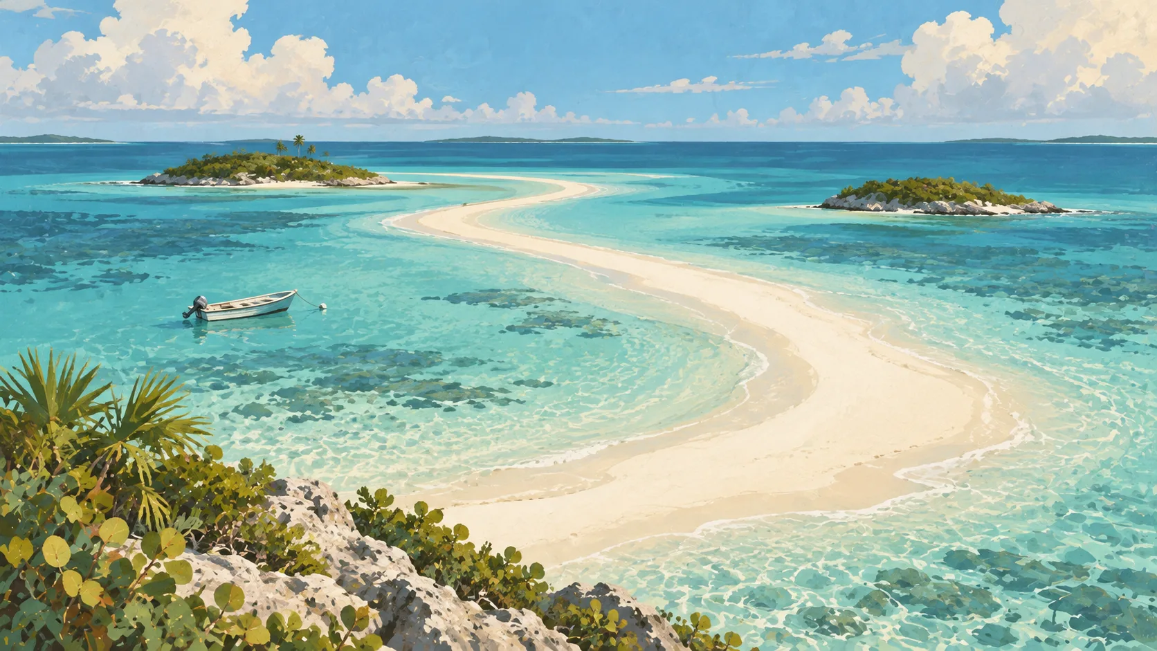
A narrow main island rewards a car and one or two bases; Harbour Island adds polished hotels and water-taxi logistics. This travel base guide groups the destination into six useful areas so the stay works on the ground, not only on a country map.
Is this your trip?
Who Eleuthera & Harbour Island is for
Road trips travellers
A narrow main island rewards a car and one or two bases; Harbour Island adds polished hotels and water-taxi logistics.
Travellers with 4–6 days
That window gives Eleuthera & Harbour Island enough room for one anchor area and one contrasting cluster per day.
Airport and water-taxi hub
North Eleuthera and Harbour Island make that interest practical rather than a country-level promise.
Area-led planners
Six fixed clusters make it easier to choose a base and avoid repeated cross-destination transfers.
Maybe not for you: A compressed checklist is the weak version of Eleuthera & Harbour Island. Treat the suggested stay as time on the ground: weather, timed entry, ferries or mountain roads can remove half a day.
Season by season
When to visit Eleuthera & Harbour Island
December–April. Rounded Caribbean maritime normals: warm trade-wind weather year-round, a drier winter-spring and wetter late summer-autumn. Conditions can still change sharply by elevation, coast and exposure, so use the chart for route timing and the current forecast for the day itself.
- Best
Dry high season
December–April
Lower humidity and rain make movement and water days easiest, with winter price pressure.
- Good
Early wet season
May–June
Warm water and lighter demand come with heavier, usually short showers.
- Mixed
Storm season
July–October
Heat, humidity and Atlantic tropical systems require current checks and flexible bookings.
- Good
Transition
November
Rain and storm risk ease unevenly before the main winter season.
Weather · monthly normals
Rounded Caribbean maritime normals: warm trade-wind weather year-round, a drier winter-spring and wetter late summer-autumn. Values are rounded planning normals rather than a live forecast.
Do fewer things better
Things to do in Eleuthera & Harbour Island
A short, ordered set of experiences with the timing or planning catch that makes each one work.
- 1
Start with Governor's Harbour
Governor's Harbour
Services and older settlement streets between two coasts
- 2
Walk North Eleuthera without stacking it
North Eleuthera
Gateway for Harbour Island and Spanish Wells
- 3
Use Harbour Island for pink-sand shore and polished stays
Harbour Island
Compact cay with high prices and golf-cart movement
- 4
Give Spanish Wells a deliberate half-day
Spanish Wells
Small island reached by local water taxi
- 5
See Gregory Town & north centre outside peak hours
Gregory Town & north centre
Quieter road stops around narrow island ridges
- 6
Keep Rock Sound & south weather-flexible
Rock Sound & south
Longer southern chapter beyond central day trips
Treat the suggested stay as time on the ground: weather, timed entry, ferries or mountain roads can remove half a day.
Area by area
The areas of Eleuthera & Harbour Island
A real map at local-city scale: enough geography to choose a base, compare areas and group a day. Numbered places match the notes below.
| Area | What it is like | Why go |
|---|---|---|
1 Governor's Harbour central base and history | Services and older settlement streets between two coasts | Use Governor's Harbour when central base and history matters more than crossing the whole destination. |
2 North Eleuthera airport and water-taxi hub | Gateway for Harbour Island and Spanish Wells | Use North Eleuthera when airport and water-taxi hub matters more than crossing the whole destination. |
3 Harbour Island pink-sand shore and polished stays | Compact cay with high prices and golf-cart movement | Use Harbour Island when pink-sand shore and polished stays matters more than crossing the whole destination. |
4 Spanish Wells fishing community and calm water | Small island reached by local water taxi | Use Spanish Wells when fishing community and calm water matters more than crossing the whole destination. |
5 Gregory Town & north centre pineapple history and coves | Quieter road stops around narrow island ridges | Use Gregory Town & north centre when pineapple history and coves matters more than crossing the whole destination. |
6 Rock Sound & south caves, settlements and space | Longer southern chapter beyond central day trips | Use Rock Sound & south when caves, settlements and space matters more than crossing the whole destination. |
Choose the base, then the hotel
Where to stay in Eleuthera & Harbour Island
For most first visits: Governor's Harbour for central base and history.
Governor's Harbour
Services and older settlement streets between two coasts Choose it when that trade-off should shape mornings and evenings.
North Eleuthera
Gateway for Harbour Island and Spanish Wells Choose it when that trade-off should shape mornings and evenings.
Harbour Island
Compact cay with high prices and golf-cart movement Choose it when that trade-off should shape mornings and evenings.
Spanish Wells
Small island reached by local water taxi Choose it when that trade-off should shape mornings and evenings.
Order with a point of view
What to eat in Eleuthera & Harbour Island
Local food is more useful as an area decision than as a checklist of famous dishes.
- 01
Conch in a careful kitchen
Governor's Harbour
Salad, fritters and cracked conch show different techniques; freshness and legal sourcing matter
- 02
Local fish plate
North Eleuthera
Ask what was landed locally rather than accepting a generic imported fillet
- 03
Peas and rice with island sides
Harbour Island
Macaroni, plantain, slaw and baked dishes carry the everyday plate
- 04
Bahamian breakfast
Spanish Wells
Stewed fish, tuna and grits make a more grounded start than a resort buffet
- 05
Fruit drink or switcha
Gregory Town & north centre
Taste seasonal fruit and lime without making rum the only island drink
Useful on the ground
Local tips for Eleuthera & Harbour Island
Plan the transfer, not only the distance
Treat the suggested stay as time on the ground: weather, timed entry, ferries or mountain roads can remove half a day.
Check entry and onward proof
Requirements depend on nationality and routing. Confirm official Bahamian entry rules and any transit visas.
Bahamian and US dollars
The Bahamian dollar is pegged one-to-one with the US dollar and both circulate locally; change may be returned in either.
Download island details
Nassau coverage is easy; smaller cays, open water and remote roads can be patchy.
Type A and B sockets
The Bahamas uses 120 V with North American-style type A and B sockets.
Common questions
Quick answers about Eleuthera & Harbour Island
- When is the best time to visit Eleuthera & Harbour Island?
- December–April. Rounded Caribbean maritime normals: warm trade-wind weather year-round, a drier winter-spring and wetter late summer-autumn. Conditions can still change sharply by elevation, coast and exposure, so use the chart for route timing and the current forecast for the day itself.
- How many days do you need in Eleuthera & Harbour Island?
- 4–6 days. A narrow main island rewards a car and one or two bases; Harbour Island adds polished hotels and water-taxi logistics. This travel base guide groups the destination into six useful areas so the stay works on the ground, not only on a country map.
- Where should you stay in Eleuthera & Harbour Island?
- Governor's Harbour for central base and history. Services and older settlement streets between two coasts Choose it when that trade-off should shape mornings and evenings.
Keep building the route
Eleuthera & Harbour Island is part of The Bahamas
Use the country guide for visa, money, long-distance transport and the route between cities. Then compare the other worked-out stops below.