
Vancouver Island: what to expect
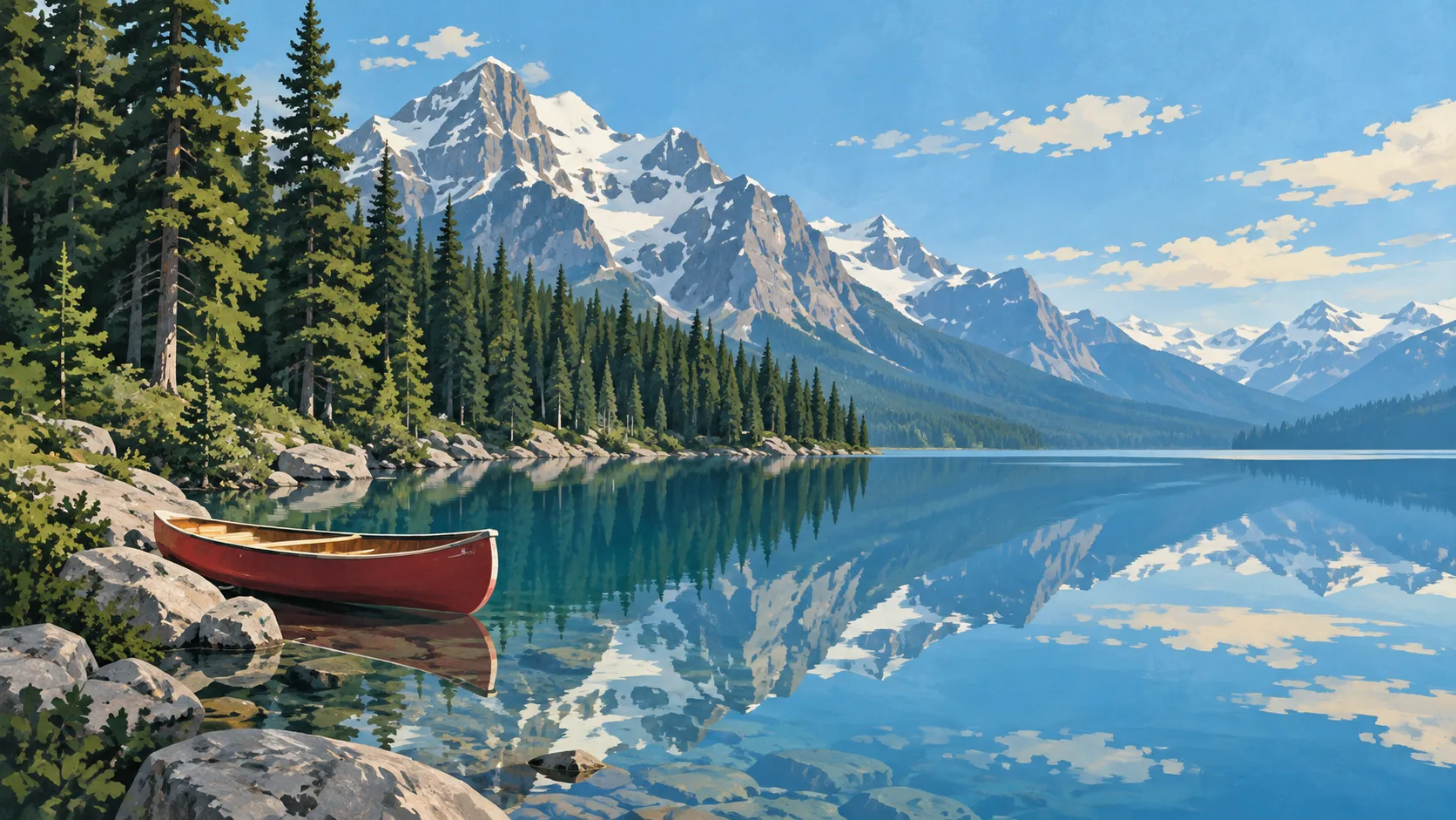
Victoria, Tofino and the island's forests need a car and a ferry or flight. Choose the west coast for wilderness, not a city checklist. This travel base guide groups the destination into six useful areas so the stay works on the ground, not only on a country map.
Is this your trip?
Who Vancouver Island is for
Wildlife travellers
Victoria, Tofino and the island's forests need a car and a ferry or flight. Choose the west coast for wilderness, not a city checklist.
Travellers with 4–7 days
That window gives Vancouver Island enough room for one anchor area and one contrasting cluster per day.
Food and farms
Cowichan Valley and Nanaimo & east coast make that interest practical rather than a country-level promise.
Area-led planners
Six fixed clusters make it easier to choose a base and avoid repeated cross-destination transfers.
Maybe not for you: A compressed checklist is the weak version of Vancouver Island. Treat the suggested stay as time on the ground: weather, timed entry, ferries or mountain roads can remove half a day.
Season by season
When to visit Vancouver Island
May–September. Rounded oceanic planning normals: modest temperature swings and rain possible in every month. Conditions can still change sharply by elevation, coast and exposure, so use the chart for route timing and the current forecast for the day itself.
- Good
Spring
March–May
Longer days and fresh landscapes, with changeable rain and cool evenings.
- Best
Summer
June–August
The warmest and longest days; book popular weekends and outdoor bases early.
- Good
Autumn
September–November
Good early colour and fewer visitors before wetter, shorter days settle in.
- Mixed
Winter
December–February
Cool, damp and dark, although cities retain strong indoor culture.
Weather · monthly normals
Rounded oceanic planning normals: modest temperature swings and rain possible in every month. Values are rounded planning normals rather than a live forecast.
Do fewer things better
Things to do in Vancouver Island
A short, ordered set of experiences with the timing or planning catch that makes each one work.
- 1
Start with Victoria
Victoria
Harbour, museums and southern-island services
- 2
Walk Cowichan Valley without stacking it
Cowichan Valley
Wine, cider and Indigenous communities north of Victoria
- 3
Use Nanaimo & east coast for ferries and route base
Nanaimo & east coast
Mainland links and calmer Salish Sea shore
- 4
Give Tofino & Ucluelet a deliberate half-day
Tofino & Ucluelet
Remote west-coast towns with reservation pressure
- 5
See Comox Valley outside peak hours
Comox Valley
Food, islands and access to alpine terrain
- 6
Keep North Island weather-flexible
North Island
Port Hardy and remote communities beyond the main circuit
Treat the suggested stay as time on the ground: weather, timed entry, ferries or mountain roads can remove half a day.
Area by area
The areas of Vancouver Island
The map is deliberately static and schematic: enough geography to choose a base and group a day, without loading a public mapping service.
| Area | What it is like | Why go |
|---|---|---|
1 Victoria first city and transport | Harbour, museums and southern-island services | Use Victoria when first city and transport matters more than crossing the whole destination. |
2 Cowichan Valley food and farms | Wine, cider and Indigenous communities north of Victoria | Use Cowichan Valley when food and farms matters more than crossing the whole destination. |
3 Nanaimo & east coast ferries and route base | Mainland links and calmer Salish Sea shore | Use Nanaimo & east coast when ferries and route base matters more than crossing the whole destination. |
4 Tofino & Ucluelet rainforest and surf | Remote west-coast towns with reservation pressure | Use Tofino & Ucluelet when rainforest and surf matters more than crossing the whole destination. |
5 Comox Valley mountain and sea | Food, islands and access to alpine terrain | Use Comox Valley when mountain and sea matters more than crossing the whole destination. |
6 North Island wildlife and quiet roads | Port Hardy and remote communities beyond the main circuit | Use North Island when wildlife and quiet roads matters more than crossing the whole destination. |
Choose the base, then the hotel
Where to stay in Vancouver Island
For most first visits: Victoria for first city and transport.
Victoria
Harbour, museums and southern-island services Choose it when that trade-off should shape mornings and evenings.
Cowichan Valley
Wine, cider and Indigenous communities north of Victoria Choose it when that trade-off should shape mornings and evenings.
Nanaimo & east coast
Mainland links and calmer Salish Sea shore Choose it when that trade-off should shape mornings and evenings.
Tofino & Ucluelet
Remote west-coast towns with reservation pressure Choose it when that trade-off should shape mornings and evenings.
Order with a point of view
What to eat in Vancouver Island
Local food is more useful as an area decision than as a checklist of famous dishes.
- 01
Market or neighbourhood lunch
Victoria
Canada's strongest city food follows migration and region, not one national menu
- 02
Local fish or shellfish
Cowichan Valley
Salmon, Arctic char, lobster and freshwater catch belong to different coasts and waters
- 03
Indigenous-led food experience
Nanaimo & east coast
Choose First Nations, Inuit or Métis businesses that control their own story and ingredients
- 04
Bakery or casse-croûte stop
Tofino & Ucluelet
Bread, meat pies, butter tarts and fry-bread traditions vary widely by province
- 05
Regional drink
Comox Valley
Cider, wine, beer, coffee and spruce or berry drinks can all locate the trip without forcing alcohol
Useful on the ground
Local tips for Vancouver Island
Plan the transfer, not only the distance
Treat the suggested stay as time on the ground: weather, timed entry, ferries or mountain roads can remove half a day.
Visa and entry
Many visitors need an eTA or visa before flying to Canada. Requirements depend on passport and arrival method; check official Canadian guidance.
Money and cards
Cards are widely accepted, but taxes, tips, fuel deposits and park fees add to the displayed price. Carry a backup card and some cash for remote stops.
SIM and data
Coverage is good in cities and along populated corridors, with large gaps in parks and the north. Download maps and park notices offline.
Plugs and power
Canada uses 120 V and type A or B sockets. European, UK and Australian travellers need an adapter and voltage-compatible devices.
Common questions
Quick answers about Vancouver Island
- When is the best time to visit Vancouver Island?
- May–September. Rounded oceanic planning normals: modest temperature swings and rain possible in every month. Conditions can still change sharply by elevation, coast and exposure, so use the chart for route timing and the current forecast for the day itself.
- How many days do you need in Vancouver Island?
- 4–7 days. Victoria, Tofino and the island's forests need a car and a ferry or flight. Choose the west coast for wilderness, not a city checklist. This travel base guide groups the destination into six useful areas so the stay works on the ground, not only on a country map.
- Where should you stay in Vancouver Island?
- Victoria for first city and transport. Harbour, museums and southern-island services Choose it when that trade-off should shape mornings and evenings.
Keep building the route
Vancouver Island is part of Canada
Use the country guide for visa, money, long-distance transport and the route between cities. Then compare the other worked-out stops below.